


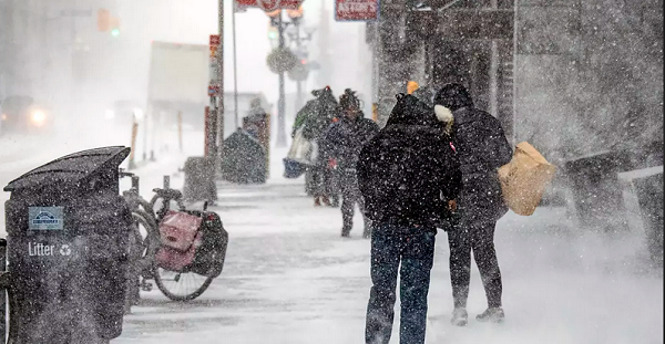
Toronto area could see up to 5cm of snow overnight: Environment Canada
Toronto and the GTA might see a snowfall spell starting Saturday evening, continuing into Sunday morning.
Environment Canada has issued a special weather statement for the GTA. It says that the region could receive around 5 centimetres of snow with more accumulation possible in some areas.
The weather agency also said that drivers should watch for slippery road conditions this weekend. The agency said it may issue a winter weather travel advisory later in the day on Saturday if conditions worsen.
Environment Canada expects snowfall to begin around 6 p.m. on Saturday, continuing until 5 a.m. on Sunday. Periods of light snow are expected throughout Sunday morning.
The weather agency said that a band of heavier snow is likely near Lake Ontario. The exact location and intensity of this band is unclear at this time.
Toronto’s snow removal plan
The city of Toronto has updated its snow removal plan in light of this most recent snowfall forecast.
In a Saturday morning press release, the city said that salting operations will begin as soon as the snow starts to stick to the pavement.
Plowing operations will be later activated when snow starts to accumulate. The threshold for when plowing will begin varies for different areas.


The city will begin plowing on expressways when 2.5 centimetres of snow accumulates. For major roads, the threshold is at 5 cm and the minimum snow accumulation that would trigger plowing operations on residential streets is 8 cm.
Snow clearing operations will begin on sidewalks and bike lanes when snow reaches 2 cm.
The city advises residents to be patient while snow clearing operations are underway. They request that residents wait 48 hours after snowfall stops before creating a service request for snow removal.
Seniors and people with mobility needs can use 211 to connect with community services and assistance.
What to expect next week
This weekend’s snowfall spell is part of a low-pressure system that is expected to cause a winter storm south of the border in eastern U.S. this weekend.


Environment Canada is expecting this system to also cause more snowfall, rainfall and windy conditions north of the border, as we go into the week.
The weather agency told the Star that it is monitoring the low-pressure system on Tuesday across southern Ontario.
In the early afternoon on Tuesday, some snowfall is expected in the GTA which could transition into rain overnight. The amount and nature of precipitation expected this week is still unclear.
Some areas in the GTA may have a rainfall warning while some others may receive snowfall warning as we get closer to Tuesday. High winds may also accompany the precipitation, Environment Canada said.
The heaviest snowfall amounts are expected in eastern and northeastern Ontario, Environment Canada said.
This article was reported by The Star